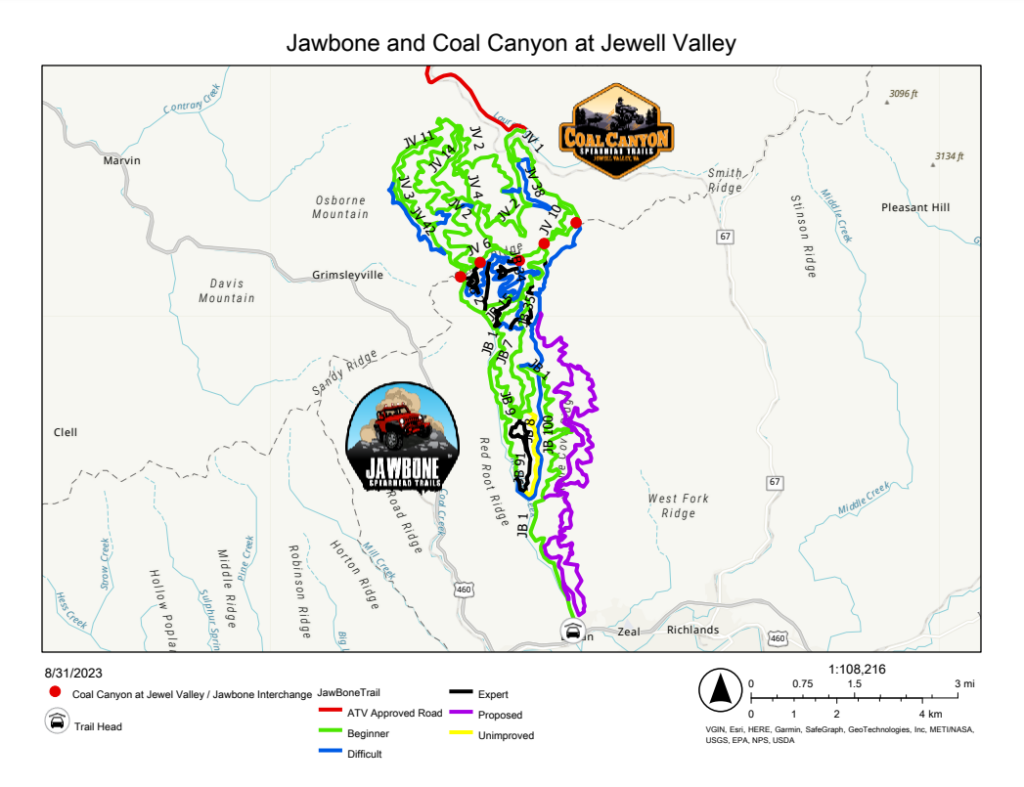
The Jawbone Trail/ Coal Canyon Trail at Jewell Valley opened on October 19th, 2019. Why two names? The trails is cut in half by the county line between Tazewell County and Buchanan County. The trail changes names from Jawbone Trail to Coal Canyon at Jewell Valley at the County line. We hope to join the Jawbone Trail throughout Tazewell County and connect to the Original Pocahontas Trail. We are also working to expand the Coal Canyon Trail at Grundy to join this to the trail and will have the different trailhead locations to distinguish the two sides of what will be a large combined system.
This trail covers a vast 10,000 acres and has 4 overlooks. This trail is unique in that it allows four-wheel drive vehicles that are street legal in addition to ATV’s, UTV’s, side by side, dirt bikes, and is well suited for dual sport bikes. The trail consist mainly of gravel roads and about 30% of the system is dirt with some sections on the Jewell Valley side consisting of scenic asphalt roads. Riders will find a play area with the same grading system of Green trails, Blue Trails, and Black Trails as well as some Yellow Trails for ATV’s only. This trail was designed for jeeps/ four-wheel drive street legal vehicles so users may find the rating of these trails easier than most of the other trails in our system. This trail also features a play area for jeeps and has some great wildlife viewing.